Danziger Straße in the district of Panow connects the Berlin districts of Prenzlauer Berg and Friedrichshain. In the upper, northern section, Danziger Straße joins Eberswalder Straße – at its southern end, it merges with Petersburger Straße at the Landsberger Allee junction. With a length of approx. 3 km, you can walk the entire length of Danziger Straße in about 45 minutes – those who take their time may need an hour or more.
History of Danziger Strasse
Over the course of its 200-year history, Danziger Straße has had to endure a number of renamings. Originally, Danziger Straße was just a simple country lane that connected the major arterial roads. This country lane has been repeatedly extended and widened since around 1822. The area was developed for the first time in accordance with the so called Hobrecht Plan, which came into force in 1862. At this time, the road was initially called Communication – a more or less technical name for the connection of the main roads.
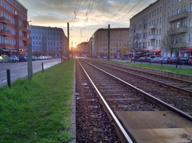
In 1874, the upper section between Schönhauser Allee and Greifswalder Straße was renamed Danziger Straße. The lower section was initially called Elbinger Straße. From around 1890, the area to the left and right of Danziger Strasse was systematically built on. In 1913, it was connected to the Berlin elevated railroad network with its own station.
In 1950, both Danziger Strasse and Elbinger Strasse were renamed Dimitroffstrasse – and the subway station was also given the name Dimitroffstrasse. For reunification on October 3, 1990, the Berlin transport company renamed the subway station after Eberswalder Straße. On November 1, 1995, Dimitroffstraße was then renamed Danziger Straße. The subway station retained the name Eberswalder Straße, which was originally intended as an interim solution.
Schönhauser Allee Junction
At first glance, Danziger Straße is perhaps not necessarily an attraction. Most of it is lined with more or less typical apartment buildings – but let’s start our walk at the junction with Schönhauser Allee.
Here, the houses are still quite close together and the streetcar shares the street with car traffic. Kebab stands and small stores, a ‘Kink & Festival Fashion’ store, a pharmacy and a launderette. On the corner of Lychener Straße is the old Berlin restaurant Zum Schusterjungen.
LSD-Kiez
A second section of Danziger Strasse begins here. The houses are further apart, the footpaths are wider and the streetcar has its own lane in the middle of the street. The three streets Lychener Straße, Schliemannstraße and Dunckerstraße branch off here on the left. Because of the initial letters, this neighborhood used to be called LSD-Kiez – but don’t worry, the nickname is only ironically related to the drug of the same name.
On the right-hand side, Knaackstraße, Hagenauer Straße and Husemannstraße meet Danziger Straße – part of the neighborhood that I would perhaps call Wasserturm- or Kollwitzplatz-Kiez.

Public clock in Husemannstraße, near Danziger Straße – Photo: T.Bortels/nuberlin.com
This second section stretches all the way to Prenzlauer Allee. If you want to explore Prenzlauer Berg a little, I would recommend strolling through the side streets of LSD-Kiez. However, if you want to walk towards Mitte, you should turn right towards Kollwitzplatz and Wasserturm. We now continue along Danziger Straße in the direction of Friedrichshain.
Winsstraßenkiez
The next section stretches between Prenzlauer Allee and Freifswalder Straße. Danziger Straße may seem a little uncomfortable on this section, and it will continue to be so. Alternatively, you could walk along one of the small side streets – but that’s not really the point of the exercise.
Halfway along, Winsstraße ends on the right-hand side. The Winsstraßenkiez, or simply Wins-Kiez, is another neighborhood in its own right, with lots of small stores, cafés, bars and restaurants – a very quiet, cozy neighborhood. A short detour is definitely worthwhile.
On the opposite side is the Wabe – a cultural and event venue that already existed in GDR times. Behind the Wabe you can see some high-rise buildings. The Wabe and the high-rise buildings form an ensemble, the architecture is more or less typical of the GDR. The Ernst-Thälmann-Park adjoins the ensemble. A little further on, behind the tower blocks, is the planetarium. This ensemble of apartment blocks, cultural institution, planetarium and park is also worth exploring – especially if you are interested in the history and architecture of the GDR.
Bötzow-Quarter
Beyond Greifswalder Straße on the right-hand side is the so-called Bötzow-Quarter or Bötzowviertel. I don’t know why this corner isn’t called Bötzowkiez, but somehow it just is.
This section stretches all the way to the next big cross street, Kniprodestraße.
Volkspark Friedrichshain
After Kniprodestraße, Danziger Straße opens up on the right-hand side to Volkspark Friedrichshain. The former FEZ leisure and recreation center forms the end.
On the left-hand side, Danziger Straße is flanked by residential buildings. You could walk along the small side streets to the Velodrom, which is embedded in the park at the Velodrom like a half-submerged UFO and can be admired from above.
Danziger Straße ends at the junction with Landberger Allee and merges into Petersburger Straße.
Parking zones in Danziger Straße
Parking zone 43
Parking zone 45
Danziger Straße on the map
By loading the map, you agree to OpenStreetMap Foundation's privacy policy.
Learn more