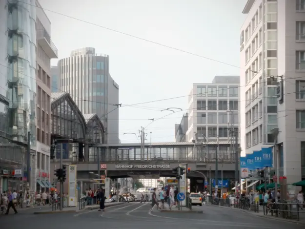
Friedrichstraße has many faces. Stretching approximately 3,300 meters, it connects Kreuzberg with Mitte, West with East, and the poor with the rich. In terms of name recognition, Friedrichstraße ranks somewhere between Kurfürstendamm and Alexanderplatz—and geographically, this classification actually fits quite well.
Friedrichstraße runs relatively straight in a north-south direction. In the north, it borders Oranienburger Tor—specifically, the intersection with Hannoversche Straße and Torstraße—and merges into Chausseestraße at this point. At its southern end in Kreuzberg, it ends at Mehringplatz; beyond Mehringplatz, it meets Tempelhofer Ufer and Gitschiner Straße, as well as Tempelhofer Ufer along the Landwehr Canal.
At approximately 15 meters wide, Friedrichstraße is rather narrow—though it may feel slightly wider than it actually is.
Shopping options in Friedrichstraße
Depending on the section, you’ll actually find small and large stores, shops, restaurants, and cafés all along Friedrichstraße.
Galeries Lafayette
Between 1996 and 2024, the Berlin branch of Galeries Lafayette—a department store belonging to the French chain Galeries Lafayette, perhaps best compared to KaDeWe—was located between Jägerstraße and Französische Straße. Currently (2026), the building is set to be converted into the Lumina office and retail complex.
A Walk Along Friedrichstraße
For a walk along Friedrichstraße, I’d recommend starting at the southern end. The Mehringdamm subway station is about 5 minutes from Mehringplatz and offers an ideal starting point for this walk.
First, we’ll cross Mehringplatz—a historic site, even if it might not seem so at first glance. The square has existed in its current form since 1734. During World War II, the area around the square was completely destroyed. Plans for its reconstruction were made in the 1960s and carried out in the 1970s.
Probably the most famous section of Friedrichstraße is Checkpoint Charlie. This was the site of one of the few border crossings between West and East Berlin.
One of the small “huts” at Checkpoint Charlie can still be seen today, even though most of the border installations—especially the Berlin Wall—have, of course, since been removed.
Mitte begins just beyond Checkpoint Charlie and Zimmerstraße. A lot of new construction has taken place here since the 1990s. However, the new developments may seem a bit bleak, since the focus back then was more on office buildings than on residential ones.
At Taubenstraße, it’s worth taking a short detour to the Gendarmenmarkt. The ensemble of the French Cathedral, the German Cathedral, and the Konzerthaus is impressive and definitely worth a quick visit.
A little further on, we cross the boulevard Unter den Linden. On the left, you can see the Brandenburg Gate—on the right, the road leads toward Alexanderplatz. On the corner is the DRIVE. Volkswagen Group Forum. On the other side, on the right beyond Mittelstraße, you’ll find the Dussmann Cultural Department Store.
Here, Friedrichstraße widens slightly—and the view opens up to the Friedrichstraße U-Bahn and S-Bahn station. Just past the station is the Weidendammer Bridge. From here, you have a beautiful view on one side of the Friedrichstraße station spanning the Spree, and on the other side, a view of part of Museum Island and the TV Tower.
Behind the bridge, on the right, is the Friedrichstadtpalast—and behind it, Oranienstraße. From here, I would recommend either continuing toward the government district or walking toward Hackescher Markt.
Parking in Friedrichstraße
Parkzone 1
Montag bis Sonntag: 9:00 Uhr – 22:00 UhrParkzone 2
Montag bis Sonntag: 9:00 Uhr – 22:00 UhrParkzone 15
Montag bis Sonntag: 9:00 Uhr – 22:00 UhrParkzone 29
Montag bis Sonntag: 9:00 Uhr – 24:00 Uhr
Friedrichstraße on the map
You are currently viewing a placeholder content from OpenStreetMap. To access the actual content, click the button below. Please note that doing so will share data with third-party providers.
More Information